
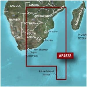
Garmin BlueChart G3 Vision VAF452S Knysna, SA-Beira, MZ Charts
R5,499
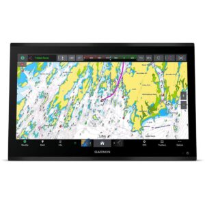
The Garmin BlueChart g3 Vision VAF452S Knysna to Beira Charts provide premium navigation along the southeastern African coast, combining official and private sources for reliable navigational aids, spot soundings, depth contours, tides and currents, and detailed harbors and marinas.
Description
Garmin BlueChart G3 Vision VAF452S Knysna, SA-Beira, MZ Charts
The Garmin BlueChart g3 Vision VAF452S Knysna to Beira Charts provide premium navigation along the southeastern African coast, combining official and private sources for reliable navigational aids, spot soundings, depth contours, tides and currents, and detailed harbors and marinas.
Designed for superior situational awareness, these charts feature high-resolution relief shading, unique 3-D views such as MarinerEye and FishEye, high-resolution satellite imagery, and aerial photography. MarinerEye offers a 3-D view of the ocean floor from below the waterline, while FishEye provides a 3-D perspective both above and below the water, giving mariners a complete view of their surroundings. High-resolution satellite imagery and aerial photos enhance orientation, showing ports, bridges, marinas, and navigational landmarks in vivid detail.
Depth Range Shading for up to 10 ranges allows quick identification of target depths, while 1-foot contours provide precise depictions of underwater structures for improved fishing charts and safe navigation through shallow waters, canals, and ports. Shallow Water Shading lets users define specific depth thresholds for added safety. Garmin Auto Guidance technology calculates suggested routes based on your boat’s dimensions, offering a clear and safe path to your destination.
The Garmin BlueChart G3 Vision VAF452S charts deliver worldwide coverage and are compatible with chartplotters that support microSD/SD cards. The package includes both a microSD card and an SD card adapter, allowing for easy installation and seamless use. With BlueChart g3 Vision, mariners enjoy the most realistic charting display available, making navigation more intuitive, detailed, and confident.
FEATURES
- Integrated Garmin and Navionics content
- Auto Guidance¹ technology
- Depth range shading
- Up to 1′ contours
- Shallow water shading
- Raster cartography²
- High-resolution relief shading
- Unique 3-D views
- High-resolution satellite imagery
- Aerial photos
Only logged in customers who have purchased this product may write a review.


Reviews
There are no reviews yet.