
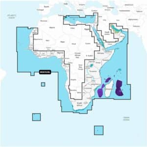
Garmin Navionics+ Vision+ NVAF630L Africa & Middle East Marine Charts
R7,699
The Garmin Navionics+ Vision+ NVAF630L Africa & Middle East Marine Charts deliver premium cartography on a microSD™/SD™ card with a one-year subscription included.
Description
Garmin Navionics+ Vision+ NVAF630L Africa & Middle East Marine Charts
The Garmin Navionics+ Vision+ NVAF630L Africa & Middle East Marine Charts deliver premium cartography on a microSD™/SD™ card with a one-year subscription included. Your purchase provides access to charts, maps and all content downloaded during the subscription period. After the included year ends, an active subscription is required to continue receiving new content such as daily chart updates.
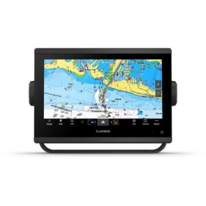
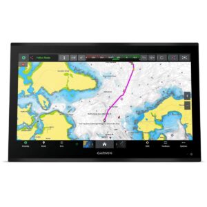
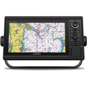
Featuring a refreshed, vibrant display with a streamlined interface, these charts combine coastal and inland content in the popular Navionics® color palette. Garmin Navionics+ cartography offers intuitive viewing that makes planning and navigating across Africa and the Middle East effortless. Designed for offshore and inland boating, the NVAF630L provides high-quality map coverage for compatible Garmin chartplotters.
Auto Guidance+™ technology calculates suggested dock-to-dock routes through channels, inlets, marina entrances and more, based on your boat’s specifications. You can customise your view using various chart layers and overlay combinations to match your preferred navigation style. With up to 10 depth-shaded ranges, anglers can quickly identify target depths, while 1’ contours reveal clear detail of underwater structure for improved fishing and safer navigation. Shallow Water Shading provides user-defined depth shading to help avoid hazardous areas.
Daily chart updates are available through the ActiveCaptain® app during your included subscription period. Community-sourced ActiveCaptain content adds valuable local knowledge, including marinas, anchorages, hazards, businesses and other points of interest.
Premium Vision+ features enhance detail even further. High-resolution relief shading blends color and shadow to make underwater topography easy to interpret. Downloadable satellite imagery improves situational awareness, and crystal-clear aerial photos show marinas, ports, bridges, docks, dams and other structures above the waterline. Advanced 3D views such as FishEye and MarinerEye deliver realistic perspectives both below and above the water’s surface. Dynamic Lake Level adjusts your mapping to current water levels, helping you determine accessibility in varying conditions.
The Garmin Navionics+ Vision+ NVAF630L is a complete, high-detail map solution for navigating the diverse waters of Africa and the Middle East, offering premium visuals, powerful routing technology and constant updates for safer, more informed boating.
FEATURES
- Navigate with our best offshore and inland lake coverage for your Garmin chartplotter.
- See it your way. Customize your view with various chart layers and overlay combinations.
- With your included one-year subscription, access daily updates via the ActiveCaptain® smart-device app.
- Auto Guidance+™ technology2 lets you navigate with suggested dock-to-dock routings.
- Select up to 10 color-shaded target depth ranges to scope out the best fishing spots.
- Save money by renewing your subscription — and continue accessing daily updates plus
Only logged in customers who have purchased this product may write a review.


Reviews
There are no reviews yet.