
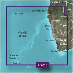
Garmin BlueChart G3 Vision VAF451S Namibia To Knysna Charts
R5,499
The Garmin BlueChart G3 Vision VAF451S Namibia To Knysna Charts offer premium navigation for mariners along the southern African coast.
Description
Garmin BlueChart G3 Vision VAF451S Namibia To Knysna Charts
The Garmin BlueChart G3 Vision VAF451S Namibia To Knysna Charts offer premium navigation for mariners along the southern African coast. Designed for precision and safety, these charts combine official and private sources to provide detailed navigational aids, spot soundings, depth contours, tides and currents, as well as comprehensive layouts of harbors and marinas.
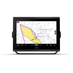
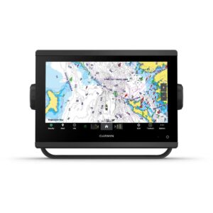
BlueChart g3 Vision enhances situational awareness with high-resolution relief shading, unique 3-D views like MarinerEye and FishEye, high-resolution satellite imagery, and aerial photography. MarinerEye offers a 3-D representation of the ocean floor from below the waterline, while FishEye provides a 3-D perspective both above and below the water, giving a realistic sense of surroundings. High-resolution satellite imagery and aerial photos display ports, bridges, marinas, and navigational landmarks for superior orientation, especially when entering unfamiliar areas.
Depth Range Shading for up to 10 ranges allows quick identification of target depths, and 1-foot contours provide accurate depictions of the bottom structure, enhancing fishing charts and navigation through shallow waters, canals, and ports. Shallow Water Shading offers customizable depth alerts for added safety. Garmin Auto Guidance technology suggests routes tailored to your boat’s dimensions, giving you a clear path to your destination.
The Garmin BlueChart G3 Vision VAF451S Namibia To Knysna Charts provide worldwide coverage and are compatible with chartplotters that accept microSD/SD cards. The VAF451S package includes both a microSD card and an SD card adapter, ensuring seamless use and maximum flexibility for confident and informed navigation.
FEATURES
- Integrated Garmin and Navionics content
- Auto Guidance¹ technology
- Depth range shading
- Up to 1′ contours
- Shallow water shading
- Raster cartography²
- High-resolution relief shading
- Unique 3-D views
- High-resolution satellite imagery
- Aerial photos
Only logged in customers who have purchased this product may write a review.


Reviews
There are no reviews yet.