
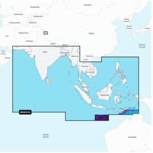
Garmin Navionics+ NAAE010L Indian Ocean & South China Sea Marine Charts
R5,299
Garmin Navionics+ NAAE010L Indian Ocean & South China Sea Marine Charts deliver an all-in-one mapping solution designed for a wide range of compatible chartplotters. Covering extensive coastal and inland areas across the Indian Ocean and South China Sea, this chart package combines detailed cartography with advanced navigation features to support confident route planning for cruising, sailing and offshore fishing.
Description
Garmin Navionics+ NAAE010L Indian Ocean & South China Sea Marine Charts
Garmin Navionics+ NAAE010L Indian Ocean & South China Sea Marine Charts deliver an all-in-one mapping solution designed for a wide range of compatible chartplotters. Covering extensive coastal and inland areas across the Indian Ocean and South China Sea, this chart package combines detailed cartography with advanced navigation features to support confident route planning for cruising, sailing and offshore fishing. Integrated coastal and inland content ensures clarity and reliability whether navigating open waters, exploring complex coastlines or entering busy harbours.
The included one-year subscription provides access to daily chart updates through the Navionics chart installer, ensuring constantly refreshed data. These updates cover new depth information, adjusted coastlines, navigational changes, added marina details, points of interest and enhancements to inland waterways. Advanced dock-to-dock route guidance uses your boat settings, depth preferences and common travel patterns to calculate suggested navigation routes across both coastal and inland regions.
Up to 1’ contours offer a precise depiction of bottom structure, delivering improved situational awareness in shallow zones, narrow channels, coastal flats, lagoons, marinas and river mouths. Selectable map options allow you to highlight shallow areas, adjust contour density or define a preferred fishing depth range. Community edits from Navionics Boating app users provide valuable local knowledge, including user-added notes, hazard markers and recommended spots, all visible on compatible chartplotters.
With Plotter Sync, you can wirelessly update charts, transfer routes, move markers and upload sonar logs between your chartplotter and mobile app. SonarChart™ Live creates new high-definition 1’ bathymetry maps in real time as you move, offering personalised underwater detail based on actual sonar data collected during your trip.
Garmin Navionics+ NAAE010L is supplied on a microSD™/SD™ card and includes all chart content downloaded during the included one-year subscription period. An active subscription is required to continue receiving new daily updates and premium downloadable content beyond the first year.
Only logged in customers who have purchased this product may write a review.


Reviews
There are no reviews yet.