
Garmin Navionics+ NSAF001R East Africa Marine Charts
R3,599
Explore the East African coastline and inland waters with confidence using the Garmin Navionics+ NSAF001R East Africa Marine Charts. This premium mapping solution combines Garmin and Navionics® content to provide comprehensive coverage of coastal features, lakes, rivers, harbors, and marinas.
Description
Garmin Navionics+ NSAF001R East Africa Marine Charts
Explore the East African coastline and inland waters with confidence using the Garmin Navionics+ NSAF001R East Africa Marine Charts. This premium mapping solution combines Garmin and Navionics® content to provide comprehensive coverage of coastal features, lakes, rivers, harbors, and marinas. Your purchase includes charts on a microSD™/SD™ card along with a one-year subscription, giving access to daily updates and any new content downloaded during that period.
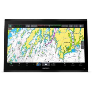
Garmin Navionics+ charts feature vibrant colors, a streamlined interface, and combined coastal/inland content with a popular Navionics® style palette. Auto Guidance+™ technology calculates suggested dock-to-dock routes, helping you navigate safely through channels, inlets, and marina entrances. Customize your view with multiple chart layers and overlay combinations to suit your navigation style, whether you are cruising, sailing, or fishing.
Depth Range Shading allows selection of up to 10 color-shaded ranges, making it easy to identify target depths for fishing. Up to 1-foot contours provide detailed depictions of underwater structures, while Shallow Water Shading highlights shallow areas to avoid. High-resolution relief shading combines color and shadow for an intuitive view of the seafloor, and high-resolution satellite imagery and aerial photography enhance situational awareness above the waterline.
Unique 3D perspectives such as FishEye and MarinerEye views offer immersive visualization above and below the waterline. Dynamic Lake Level functionality allows adjustment for current water levels to determine accessibility of fishing or cruising spots. Access community-sourced content via the ActiveCaptain® app, including recommendations for marinas, anchorages, hazards, and points of interest.
The Garmin Navionics+ NSAF001R is a complete charting solution for East Africa, providing rich, real-time navigation, safety, and situational awareness for both coastal and inland adventures.
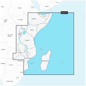
Coastal coverage of the east coast of Africa from Maputo Bay to the Horn of Africa, Zanzibar, Madagascar, Mauritius, Reunion and the Seychelles. Coverage includes the ports of Maputo, Mozambique; Dar es Salaam, Tanzania and Mombasa, Kenya.
Verify that your device is compatible. If your device is not compatible, you can still purchase g3 charts.
FEATURES
- Navigate with our best offshore and inland lake coverage for your Garmin chartplotter.
- See it your way. Customize your view with various chart layers and overlay combinations.
- With your included one-year subscription, access daily updates via the ActiveCaptain® smart-device app.
- Auto Guidance+™ technology2 lets you navigate with suggested dock-to-dock routings.
- Select up to 10 color-shaded target depth ranges to scope out the best fishing spots.
- Save money by renewing your subscription — and continue accessing daily updates plus new content downloads.
Only logged in customers who have purchased this product may write a review.


Reviews
There are no reviews yet.