
Garmin BlueChart G3 Vision Eastern Africa Coastal And Inland Charts
R6,599
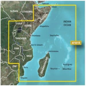
The Garmin BlueChart g3 Vision Eastern Africa Coastal and Inland Charts provide advanced navigation for mariners exploring the Eastern African coastline and inland waters.
Description
Garmin BlueChart G3 Vision Eastern Africa Coastal and Inland Charts
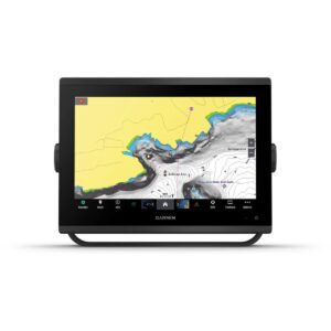
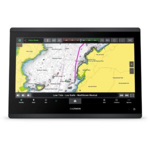
The Garmin BlueChart g3 Vision Eastern Africa Coastal and Inland Charts provide advanced navigation for mariners exploring the Eastern African coastline and inland waters. Delivered on a microSD/SD card, these charts combine official sources with private data to offer detailed navigational aids, spot soundings, depth contours, tides and currents, and comprehensive harbor and marina layouts.
BlueChart g3 Vision adds high-resolution relief shading, unique 3-D views, high-resolution satellite imagery, and aerial photos, giving you a realistic perspective of your surroundings for safer and more confident navigation. Depth Range Shading for up to 10 depth ranges allows you to quickly identify your target depth, while 1-foot contour lines provide accurate depictions of the bottom structure for enhanced fishing charts and navigation in shallow areas, canals, and ports. Shallow Water Shading enables depth-specific alerts to help you avoid hazards.
These charts offer worldwide coverage and are compatible with devices that have a microSD/SD card slot. For desktop planning and route management, Garmin BaseCamp™ software can be used. The microSD/SD card package includes both a microSD card and SD card adapter, ensuring flexible and advanced charting capabilities.
FEATURES
- Integrated Garmin and Navionics content
- Auto Guidance¹ technology
- Depth range shading
- Up to 1′ contours
- Shallow water shading
- Raster cartography²
- High-resolution relief shading
- Unique 3-D views
- High-resolution satellite imagery
- Aerial photos
Only logged in customers who have purchased this product may write a review.


Reviews
There are no reviews yet.