
Garmin Navionics+ NAAF004R Northwest Africa Marine Charts
R3,599
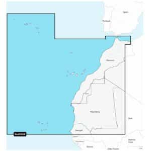
Garmin Navionics+ NAAF004R Northwest Africa Marine Charts provide an integrated mapping solution designed for a wide range of compatible chartplotters, offering clear and reliable coverage across both coastal and inland waters.
Description
Garmin Navionics+ NAAF004R Northwest Africa Marine Charts
Garmin Navionics+ NAAF004R Northwest Africa Marine Charts provide an integrated mapping solution designed for a wide range of compatible chartplotters, offering clear and reliable coverage across both coastal and inland waters. This all-in-one mapping option includes detailed offshore and inland lake content, allowing seamless navigation throughout Northwest Africa. Navionics+ combines advanced guidance capabilities with flexible chart-layer customisation, ensuring you can tailor map views and overlays to suit your navigation or fishing needs.
Users can adjust contour density, highlight shallow areas or select a specific fishing range, making it easy to focus on the information that matters most. Up to 1′ contours offer exceptional clarity of bottom structure, providing detail in swamps, canals, harbours and marinas while also enhancing fishing charts. Daily chart updates ensure continuously evolving accuracy, with thousands of global enhancements applied each day. These updates, along with new downloadable content, can be accessed using the Navionics chart installer during the included subscription period.
Advanced dock-to-dock route guidance technology uses your vessel settings, chart data and commonly travelled routes to calculate suggested paths for effortless navigation. Community edits supplied through Navionics Boating app users contribute valuable local insight, including markers, notes and additional information that can be viewed directly on compatible chartplotters. Plotter Sync enables wireless transfer of routes, markers, sonar logs and chart updates between the chartplotter card and mobile app, while also supporting subscription activation or renewal.
SonarChart™ Live mapping allows the creation of real-time 1’ HD bathymetry maps as your vessel moves across the water, building personalised underwater detail with every trip. For additional advanced visual enhancements, premium Navionics Platinum+™ features can be added. These include high-resolution relief shading for clearer interpretation of underwater structure, sonar imagery highlighting changes in bottom hardness, downloadable high-resolution satellite imagery for realistic overviews and crystal-clear aerial photography of harbours, marinas, bridges and navigational landmarks. Unique 3D views provide added situational awareness both above and below the waterline, helping you navigate unfamiliar locations confidently.
Garmin Navionics+ NAAF004R delivers detailed mapping, extensive coverage and advanced customisation for reliable navigation across Northwest Africa. Your purchase includes charts, maps and any content downloaded during the included one-year subscription period. An active subscription is required to continue accessing new content such as daily updates after the one-year term ends.
FEATURES
- Navigate with our best offshore and inland lake coverage for your compatible chartplotter1.
- See it your way. Customize your view with various chart layers and overlay combinations.
- With your included 1-year subscription, access daily updates via the Navionics® chart installer software.
- Advanced route guidance technology lets you navigate with suggested dock-to-dock routings.
- Selectable map options let you highlight shallow areas, adjust contour density or select a fishing range.
- Save money — while continuing to access daily updates plus new content downloads — by renewing your subscription.
Only logged in customers who have purchased this product may write a review.


Reviews
There are no reviews yet.